| A Summer Road Trip to Wichita June/July 2005 Page 3 |
Day 3
It took only a few minutes to leave the campground and head out into the Bonneville Salt Flats. I remember the first time I drove across the salt flats, it seemed so far across. After traveling this way several times, the trip across the salt flats goes much more quickly.
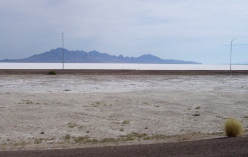 The famous Bonneville Salt Flats on the North side of I-80 |
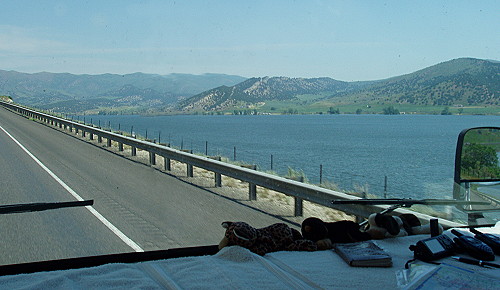
There is a point on I-80 where we left the salt flats behind and began driving next to the Great Salt Lake. In the years we've traveled this route, we've seen the level of the lake recede so far that none of the recreation facilities were close to the water. Then one year, the lake level had risen so high that the same facilities were flooded.
This was the time that the lake flooded I-80 and the level the roadway had to be raised twice. At one point there was water on both sides of the highway with the water lapping just inches below the road surface. Even with the lake level lower there still is a short section of I-80, on the south side of the lake, that has water on both sides.
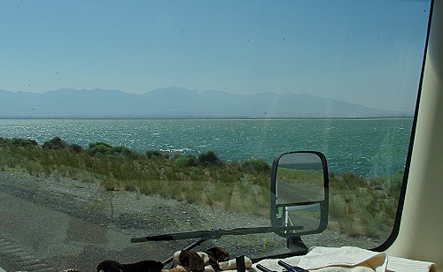 Driving with water on both sides of the highway seems strange |
As we turned northeast heading toward Salt Lake City, it was decided to take a break before entering the turmoil of Salt Lake City traffic. We stopped for awhile at a roadside rest stop where we had a view of the lake. The level seems to be normal at this time.
We arrived in Salt Lake City after rush hour. As a result, our drive across the city went well as compared to previous trips. Salt Lake City has always seemed to be a challenge to get from one side to the other without taking an unplanned side trip.
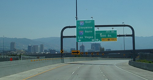 I always dread the trip across Salt Lake City — However, this time was easy |
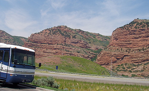
After getting across the city, we were making a very long uphill climb — on eastbound I-80 heading for Evanston, Wyoming — winding our way through a red rock canyon. In years past, this section of highway threatened to cause the engines of various vehicles to overheat. Our vehicle this time — our Monaco Knight — made to climb without overheating. The engine-transmission combination did a really good job of putting the incline behind us.
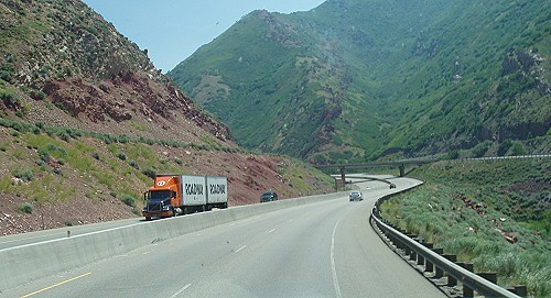 Part of the long uphill climb traveling on I-80 northeast of Salt Lake City |
After reaching the top of the upgrade the road leveled out as we began driving next to Echo Reservoir. I pulled into a vista area to look over the lake. I took a serious of photos to assemble a pseudo-panaramic view of the lake.
 A driving view of Echo Reservoir |
|
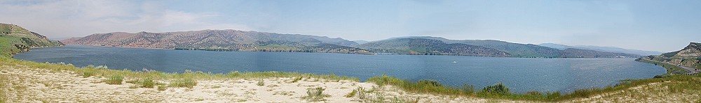
 Echo Reservoir vista point |
From the vista point we continued on to the long downhill stretch of the highway as we were going northeast toward Evanston. I found my way to a familiar roadside rest area where I pulled in for a lunch break. This is a familiar place from previous travels this way. This was the place where we parked overnight in our little van camper during its first cross country trek.
The rest area is located among red rock formations making for a very scenic place to have our mid-day meal. Near the restroom building was a tree like I not seen before or I haven't seen such a tree at this time of year. The tree had large numbers if seed pods hanging down. At first glance the seed pods looked similar to maple tree seeds. Upon closer inspection, I could see that, instead of the wings on maple seeds, each seed had a little balloon structure.
 Scenic rest area among red-rock formations |
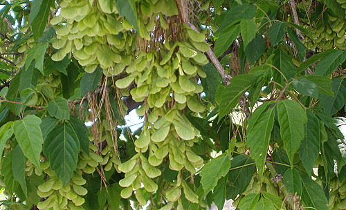 Strange looking seed pods of a tree at red-rock rest area |
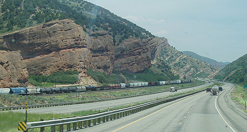
There we several long freight trains going through the canyon with us. We also saw a lot of long trains in Wyoming. I don't know if it is still true, but at one time when we drove through Wyoming, the railroad industry was the largest employer in the state.
Ahead is a long downhill run. —
We saw a lot of long trains on this trip. |
Once we reached Wyoming, we enjoyed a nice easy-going drive across the high desert/prairie. We once again traveled through one of a pair of tunnels that were built as part of the Interstate Highway construction. We also came across another very long freight train.
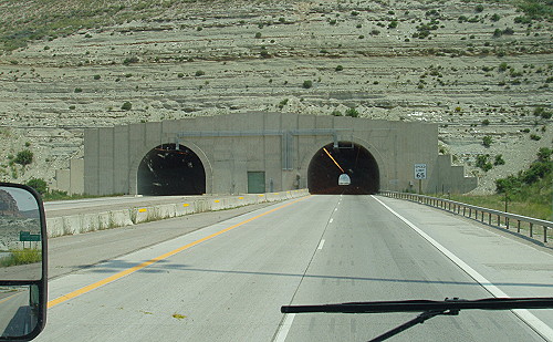 Yet another pair of tunnels for us to get through |
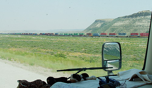 One of many very long trains seen on our trip |
The weather has been very comfortable considering we were expecting to be traveling in very hot weather. We reached the high desert plains where there is an interesting geographic feature — you get to cross the continental divide twice. On the way to Rawlins eastbound there is a shallow basin where the continental divide splits and goes around the geographic depression. Any water flowing inside the basin goes neither to the Pacific nor the Atlantic oceans.
We came across something I've only heard of and glad I've never had to deal with it. In the winter time, the weather gets bad enough that the freeway has to be closed. There were several places where gates could be closed with traffic being required to make a U-turn and go back the way they came.
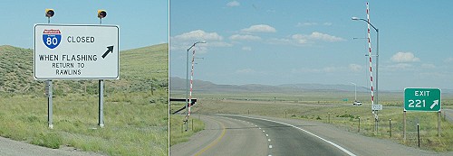 I hope I never need to make this U-turn |
I like traveling this time of year because the countryside is so green with the rivers and streams flowing with the runoff from the rain storms. The new grasses and foliage attracted a lot of pronghorn antelope to feed in the fields along the highway. It was also fun to see all the baby animals in the fields next to the Interstate. We saw several of the following: New colts - baby calves - little goats - baby llamas - lambs.
East of Rawlins, even though the weather was very nice, we could tell we were in snow country. There was still a little bit of snow on the mountain tops. However, the thing that really tells the story is the long rows of snow fences. Mile after mile we saw snow fences spaced out on the hillsides sometimes in several rows.
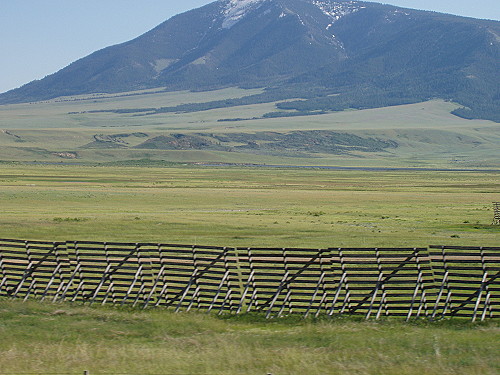 Snow fences let us know that we are in serious snow country |
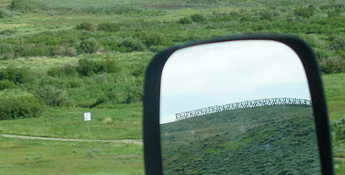 A view of a snow fence behind us as viewed in the rearview mirror |
Before reaching Laramie, we saw something that is new to us, a long row of wind-powered generators. The line of generators could be seen long before we crossed the path made by the machines. The generators were in a line positioned on a ridge that intersected the highway. From a distance, the spinning propellers looked somewhat like a row of animated flowers. The line of wind turbines ended just north of Arlington, Wyoming.
Click on picture below to view a larger version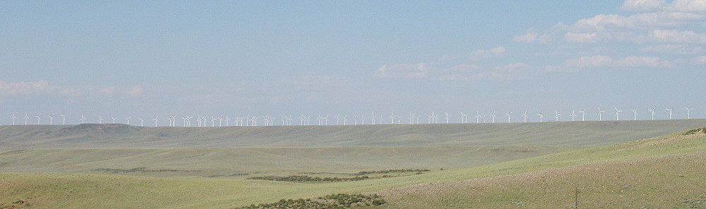 We could see this row of wind turbines a long time before we reached them |
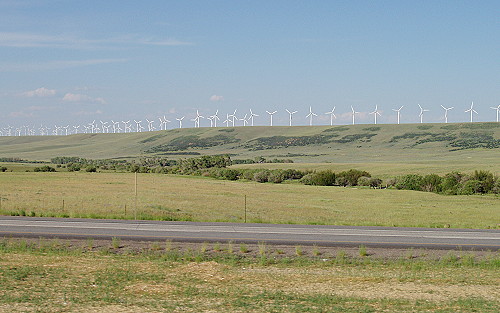 Our view shortly before crossing the southern end of the line of generators |
Our plan was to spend the night near Cheyenne, Wyoming, but it was decided to end our day a little short of our goal by stopping for the night at a Laramie RV campground. This place is surrounded on three sides by trailer houses and on the forth side was the Interstate. I was given the password to connect to a wi-fi hotspot that turned out to be out of order. Oh well, I will have to try later to connect to the outside world.
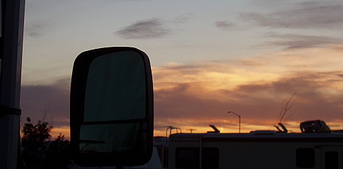 This sunset is the best thing I could find about this RV campground |
| [ SUMMARY ] | [ PREV ] | [ NEXT ] | [ RV FUN TRIPS ] |
If you have comments or suggestions, please contact the .
Copyright 2007, RVFunTrips.com. All rights reserved.