| A Trip to the Southwest and the Plains November/December 2007 Little Rock — Page 3 |
Little Rock
The weather on our first day in Little Rock was cloudy with a forecast for
rain. We even heard what at first sounded like thunder. However, after listening
for a short time, it was determined that the sounds we heard were those of
big military guns located at an Army base on the other side of the hill from
the park. The sound reminded me of the sounds of gunnery practice on board
my U.S. Navy ship many years ago.
Even though rain was predicted during the day, we decided to go into town and get familiar with the surrounding area. Our main reason for being here was to attend a concert on our last night in the area, so we wanted to check out the area around the concert venue.
We were staying in an RV campground that actually is in the town of North Little Rock and this also is the location for the concert we were here to see at the Alltel Arena. I circled the arena a couple of times to learn where the parking lots are located as well as what route to take to get back to our motorhome after the concert.
Once we felt as if we knew what we needed to go to the concert I headed to the freeway to go across the Arkansas River to go to Little Rock. I followed information signs that took us to the Little Rock Visitors Center. The center is an old mansion — Historic Curran Hall — that is nice to see in its own right. While there I loaded up on pamphlets and brochures for all sorts of tourist attractions.
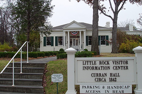 A well preserved old house provides a nice place for information center |
 The interior of the old house has been furnished in period furniture |
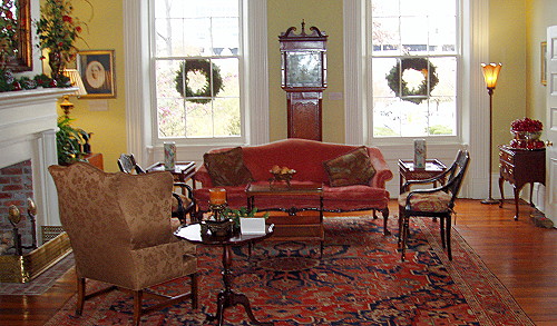 Yet another well kept room |
I found my way to the waterfront area where the Clinton Presidential Library is located. After locating many of the local attractions we decided to go back to the motorhome due to the weather beginning to get blustery. I figured today's trip would be exploratory in nature so we will have an easier time getting around during the days ahead.
We went back to the RV campground to spend the afternoon in our cozy little residence on wheels. Kay worked on a couple of her hobbies while I read magazines and worked with my computer. Even though our trek to Little Rock was short, we accomplished our plan to get familiar with the area.
We had a nice rain during the evening and on into the night.
Next Day
The day opened with a nice sunny view of the grove of trees outside the window of our motorhome. The dampness from last night's rain had mostly gone away. Today we would be doing the touristy thing. The plan is to visit the presidential library, check out the capitol building and any other sights that we can find.
The William J. Clinton Presidential Library was very interesting. There was enough there that I have given it a page of its own. From the Clinton Library we headed over to the State Capitol building.
Click on image below to view a larger
version Arkansas State Capitol building |
When we got to the capitol it looked as if some sort of special occasion was going to take place. There were canopies set up on the grass in front of the building. I took a few pictures and moved on to the surrounding grounds.
There is a work of bronze that is a tribute to the nine young African-American students who enrolled and insisted on attending the all white Little Rock Central High School in 1957. This became a major milestone in American civil rights history.
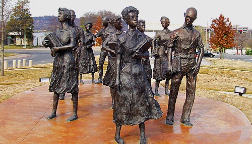 "Testament" Civil Rights Memorial Sculpture of the Little Rock Nine |
This brought back memories of my own high school years. When I was attending high school in Wichita, Kansas, my school was integrated. I had always attended integrated schools. In 1958 a new student showed up at our school and she had a noticeable southern accent. I asked about where she was from and she said that she was from Little Rock. She also said that her high school was shut down by the governor. She and her family felt that her education was very important, so her parents sent her to live with her aunt in Wichita so she could continue her high school education.
I moved on to look at another display that looked familiar. It was a reproduction of the original Liberty Bell that was rung as part of announcing our country's independence from England. The dimensions and tone are identical to the original Liberty Bell. The bell on display is one of fifty-three bells cast in France in 1950 and given to the United States government. The bell seemed to be smaller than I would have expected it to be. Also located on this site is a time capsule that is to be opened in 2075
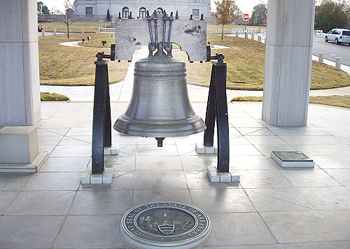 A reproduction of the original Liberty Bell |
From the Capitol we found our way to the Clinton Museum Store where souvenirs can be purchased. Some items are things that were used by the president such as golf clubs. There are three maps on the wall; one is a world map and the other two are United States maps. The maps are hung one above the other with a U.S. map on top and bottom with the world map in the center. The maps have red push-pins stuck in locations on the maps that represent the locations of where visitors live.
The top U.S. map is out of reach because there is no room left for pins. The lower of the U.S. maps still has room for a few more pins. I inserted a pin in the approximate location of our city.
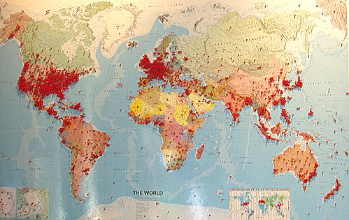 Pins show the far flung home locations of visitors |
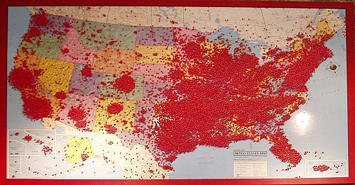 This map is displayed high because there is no more room for pins |
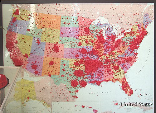 I put a pin in this map at the approximate California location where we live |
There were a couple of ball caps — an Air Force One hat and an FBI hat — that I would like to have purchased, but I decided that I already had enough hats that I don't wear.
From the museum store we took off for home where we arrived shortly before sunset. I took the opportunity to take a walk around the campground. It turned out to be bigger than I thought. With the small hill in the middle of the campground the walk around the perimeter turned out to be a good workout — something that I've needed on this trip. It was a nice way to end the day.
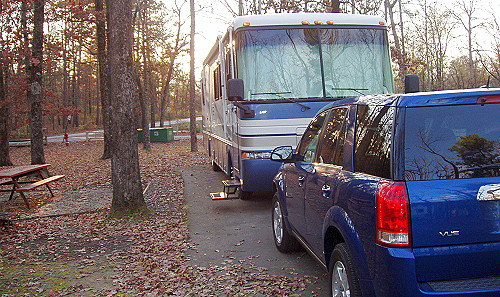 Our home base for a few days |
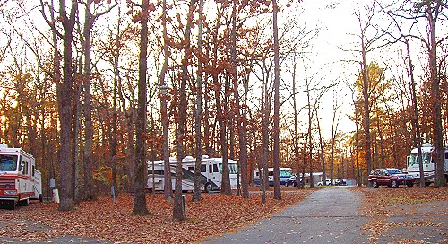 Looking down the street from our campsite |
| [ BEGIN ] | [ PREV ] | [ NEXT ] | [ RV FUN TRIPS ] |