| A Trip to the Southwest and the Plains December 2007 Return to California — Page 4 |
Nevada to California
The day began, like many others on this trip, when we woke up without any
concern about what time it was. The day was a bit dreary outside with heavy
overcast.
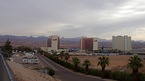
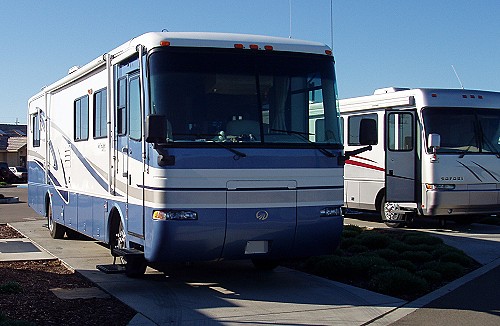
 Our Laughlin campsite — Edgewater Hotel-Casino can be seen in the distance |
We were going to begin our day with a breakfast at the casino buffet. I usually like the choices that are presented at a buffet style restaurant. We had a nice quiet meal again seated at a table overlooking the Colorado River. We were able to see even more activities now in the light of day.
After breakfast it was no surprise that Kay wanted to spend a little time at the slots. It was almost too easy; we just walked out of the buffet into a room full of slot machines. As usual, I tired of the mechanized money thieves before Kay was ready to quit. This would give me a chance to move our motorhome from the RV park, before checkout time, to the casino parking lot.
 Our view of casino-row as we head out to go to breakfast |
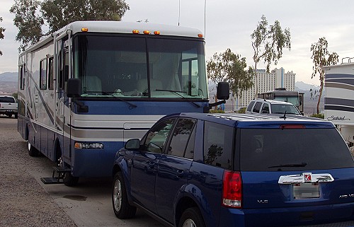
 Parking spot while waiting for Kay |
I found an open area in the casino parking lot that was long enough for our motorhome to fit and provide an easy exit. While waiting for Kay to tire of keeping Nevada green, I turned the TV on to look at weather forecasts. What I saw was a bit unsettling. There was a big storm coming into the southern California area where we planned to spend the night.
Shortly before noon Kay came from the casino to the motorhome. We had a quick lunch at which time I told Kay about the ominous forecast I saw on TV. We had planned to get over the Tehachapi Mountains to the south end of the San Joaquin Valley where we would find a RV campground.
The forecast was for a big storm to come in from the south with rain and snow at the higher elevations. It was predicted that there would be enough snow to close both the grapevine on I-5 as well as highway 58 at the Tehachapi Pass — the route we were taking. Then hurricane force winds were forecast for the San Joaquin Valley as well as the desert area we would be traveling through on the way to the Tehachapi Pass. There were warnings for high-profile vehicles.
With the news of the upcoming storm Kay and I decided that we would try to get as far as we could before we stopped for the night. I didn't want to get trapped in the big valley with possible hurricane force winds the next day. As we took off and found our way out onto the Mojave Desert we could see signs of the coming storm as the clouds changed during the afternoon.
We were passed by two big rigs that were carrying a load of hay that was baled the way it was when I was a kid. On this trip we saw a lot of hay that was bailed in big rolls that weigh way too much — up to 2000 pounds — for a person to pick up. The bales I remember were rectangular in shape with a square cross section. The bales weighed anywhere from 50 pounds to over 100, but that's another story.
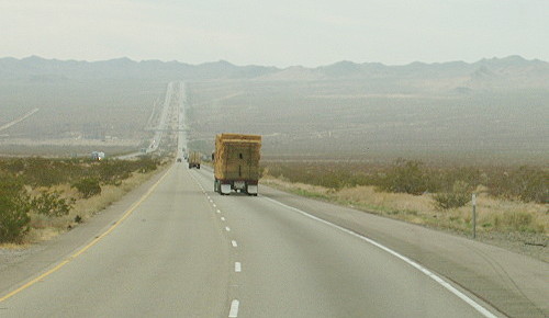 Two big rigs loaded with hay, baled the old fashioned way, passed our motorhome |
Fortunately traffic was light on I-40 as we scurried across the Mojave Desert. When we first traveled this way all I wanted to do was to get across the desert. After many years of driving across this great expanse, I've come to enjoy the trip a bit more — especially when traffic is light enough that it allows me to look around more than when surrounded with vehicles. It seems as if I see something new and different each time we come this way.
I noticed a couple of ancient lava flows that I may have seen on past trips, however, I don't recall seeing these geologic features before. The black volcanic rocks were strewn in a large area on both sides of the highway. I'm guessing that stuff must cause problems when building a highway. The black volcanic stone can have surfaces that are like broken glass.
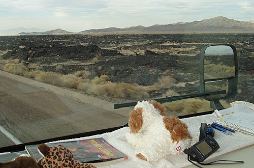 Black lava rock from a long-ago volcano eruption and lava flow |
Soon a familiar sight appeared out in a desert valley in the form of a solar power plant. The power plant is the type where a large number of mirrors — heliostats — reflect sunlight to the top of a central tower that gets white-hot. The heat in the tower is used to superheat a liquid that is then used to drive turbine powered electric generators. This particular solar power project is located just east of Barstow, California out in the sunny Mojave Desert. I've noticed a lot of new solar project sites on this trip such as the very large field of solar collectors north of Kramer's Junction.
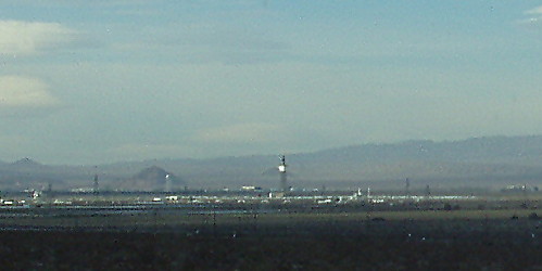 Solar-powered, electric generator appears to be at work |
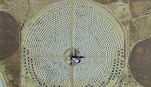 Solar power plant as seen from above — Photo from Mapquest.com |
It was nice to get to Barstow — one of our milestones on this route — sooner than I expected. We've been listening to the radio for regular updates of the progress of the coming storm. So far, we've been fortunate to be sailing along with a nice tailwind; that will change when we get to the other side of Barstow. However, before Barstow we passed by Daggett, California, which is a favorite location for railfans due to the large rail yard in Daggett.
Going from I-40 to California Highway 58 the route takes a turn to the north, the tailwind that had been pushing our motorhome became a cross wind for a few miles. During the time I was driving north, I had to maintain my concentration on driving to keep our rig in our lane.
Once we were west of Barstow, on highway 58 out in the open, the wind was again mostly coming from behind our motorhome. Railroad tracks were now running parallel to the highway for a short way. This is where we saw yet another very-long train headed east, loaded with cargo containers. Some of containers were stacked two levels high. There were three engines in the front and two engines pushing from the rear.
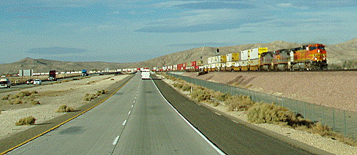 It seems as if this is the trip of long freight trains |
As we headed toward the town of Mojave, I noticed some interesting cloud formations that I figured were the result of the coming storm. The shapes of the clouds looked somewhat lenticular, if so, that probably meant that the mountains we not far away. I really wanted to get over the Tehachapi Mountains before the coming storm arrived so we wouldn't be delayed by snow in the pass.
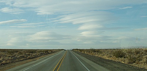 Interestingly shaped clouds ahead of us |
As the highway began to ascend from Mojave to Tehachapi, the wind powered generators were working hard. At the bottom of the mountain ridge where many of the generators live, another long freight train was coming down from the Tehachapi Pass. The train was being pulled by four engines or power units as they are known by railroad people.
We made it to the Tehachapi Pass just before the sun went down behind a dense bank of clouds. On the radio we heard reports of the wind that was blowing across the Mojave Desert. There were gusts up to 50 miles per hour with much higher speed gusts expected later. Apparently we had gotten out of the desert just in time. I also heard that it was raining hard on I-5 in the grapevine area. The forecast was for the rain to turn to snow during the night.
The long downhill ride on highway 58 heading for Bakersfield was a bit unnerving at times. A couple times our motorhome was boxed-in by 18-wheel big rigs as we careened down the winding mountain road. It was white knuckle driving for a short time. Fortunately, there was enough light in the sky that it was fairly easy to see around the motorhome.
The sun set before we arrived in Bakersfield. This meant that we had to deal with commute traffic after dark — never one of my favorite things to do. By now the wind was blowing a steady 25 miles per hour, the forerunner of the coming storm. I was heading for a place we usually visit in this area — the Flying J Travel Center where we would refuel. I like this particular location because we can stop for fuel and get a quick meal all in a single stop.
I didn't want to dally, so as soon as were finished with our meal I took off on northbound US-99, however, we weren't on 99 for very long. I took the California Highway 46 exit from 99 and headed out into the farming area that is located between US-99 and I-5.
I was a bit relieved to reach I-5 before the big blow. As usual, I-5 had heavier traffic than we had become accustom to during our trip. I was glad to see that much of the freeway has been resurfaced — still there are too many bumpy sections. As we drove north the weather was degrading with rain beginning to give our windshield wipers a workout. Still, we weren't experiencing anything like what was forecast. I turned on the radio to listen to the news. It was then that I heard that we had really escaped some terrible weather that was raging in the desert east of Los Angles as well as the area we had crossed earlier. I was very glad that we had decided not to stop sooner. Now we had to find a place to stay for the night.
As I drove I continued to listen to the radio to find out just how bad the weather was supposed to get before morning, what I heard bothered me. Winds in the San Joaquin Valley were forecast to be hurricane speeds with high-profile vehicle warnings. I was concerned that if we stopped for the night we might not be able to get back on the road the next day in time to make it to an RV club meeting as scheduled.
With a short discussion we decided to try to get all the way to Lodi, California where the RV club meeting was to be held, so into the night I drove. I figured that there would be no need to stop for fuel so we should be able to make it okay. Then the wind began blowing harder and the rain began falling continuously.
When we were almost an hour away from our destination, the wind really began to blow and the increasing rain was streaking down at a sharp slant. Now I was beginning to think that we might be forced off the highway before reaching our destination.
As we entered Manteca, California the wind had become a cross wind that was blowing the heavy rain horizontal. At times the rain was heavy enough to overwhelm the windshield wipers — I was very glad that I had installed new wipers before starting our trip.
It now was late enough that I didn't want to enter the RV campground and have to setup in the stormy weather. So, my goal was to get all the way to the Flying J Travel Center in Lodi where I could refuel our motorhome and get some sleep in the RV parking area. We made it to our destination a few minutes before 10 pm — about 10 hours after leaving Laughlin, Nevada in the morning — and it felt very good the get off the freeway. I pulled up the the RV refueling pumps where I was happy to find that our motorhome blocked the wind driven rain while I filling the fuel tank.
It appeared as if others had the same idea, there were only two RV parking spaces empty. I pulled into one of the spots and shut the engine down — ahhhhhh what a relief, especially with the storm raging outside. I turned the TV on for a short time, long enough to get a check on the weather. The hurricane force winds were blowing across the southern end of California's central valley where we had been a few hours earlier. It was nice to crawl into bed to get a good night's sleep as rain made a soothing sound on the roof.
This was a restful end to another of our really great RV Fun Trips.
| NOTE: | The next morning I would learn that several big rigs, including one motorhome, had been blown over during the storm in the southern part of the California central-valley. |
 Our last campsite for the trip |
| [ BEGIN ] | [ PREV ] | [ NEXT ] | [ RV FUN TRIPS ] |