| A Trip to the Southwest and the Plains November 2007 The Southwest — Page 5 |
On the Road to Tucson
We left Las Vegas around 10 o'clock. I found my way to a route, in Las Vegas,
that included three highways — US-93, US-95 and I-515. Turning south
onto US-95 we were in new territory for a short time until we reached the
junction with Nevada State Highway 163 which is where we've turned south as
we left Laughlin on previous trips. Now we would be seeing very familiar scenes
on our way to Kingman, Arizona.
Whoops! There is a sign telling us that we've just entered the Mountain Time zone which means we just lost one hour — something I overlooked in our travel plans.
After entering Arizona I saw a familiar sight next to the Interstate — old route 66. This section of US-66 is in good repair which means it is still well used. Most times I see the old highway it is in bad shape with weeds sometime growing through cracks in the old pavement.
Something that would become a very common sight was a very long freight train traveling some distance from the highway. Usually the trains can be seen in the distance as they take a different route from the highway which can be seen in valleys far away. Finally the railway procession disappears behind a mountain just as another train appears, in a different location, coming our way.
When time for lunch arrived I pulled into a road side rest area where we've stopped on previous trips this way. The stop gave us a welcome rest from the road. After a nice lunch break we got back on the highway.
An unusual yet familiar structure appears rising over the horizon, it is a geodesic dome home just off to the side of the freeway. Even though the building looked familiar, it somehow looked different. I referred back to my story about our trip in November of 1999 where I found a photo of the strange structure. It appears as if it has been painted a gray color instead of white as was in the past.
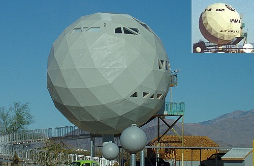 This unusual building has changed since we last saw it. — See inset above — |
I saw an information sign on I-40 that I don't recall seeing on previous trips this way. The sign was letting us know that one mile ahead of us Shinarump Dr and Oatman Hwy are reachable via EXIT 44. I find the first road name a bit unusual, but I'm sure there is a rational reason for the name.
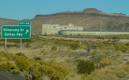 A road with a somewhat unusual name |
We made our usual refueling stop at the Kingman Flying J travel Center. From there, the scenery was very familiar from years past when we "commuted" to our hometown for holiday visits with our families. We now were on our way to the point where US-93 turned south toward Phoenix.
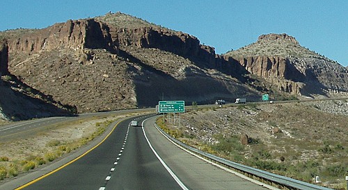 The sign ahead tells us that we are nearing our turn-off for US-93 |
When it came time to turn south on US-93, rock formations new to us appeared on both sides of the highway. It wasn't long until saguaro cacti began showing up. The numbers of saguaro increased to a point that was more than I've seen before. The various shapes were at times fascinating and other times humorous.
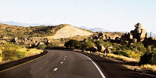 Rock formations are interesting along this stretch of highway |
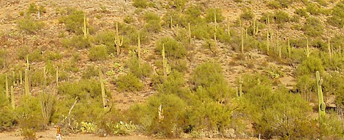 Saguaro cacti grow in great numbers on both sides of the highway. |
It seemed as if we would be driving through saguaro country for the rest of our trip to Phoenix. The the cacti was replaced by joshua trees. Many of them were fairly large with many branches. At one point it almost looked as if we were driving through a forest of short trees. Then the Joshua trees thinned out and the landscape was covered with prickly pear cacti. All this desert flora makes for an interesting drive and seems to compress time making the trip seem shorter.
On this route we drove through small towns with interesting names that I've heard from friends who've come this way before. Two of the towns were Wickieup and Wickenburg where I saw an old movie theater that had the appropriate name of Saguaro.
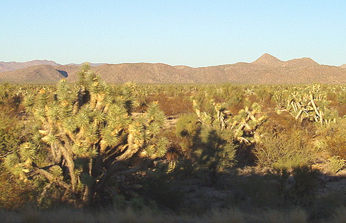 A forest of joshua trees |
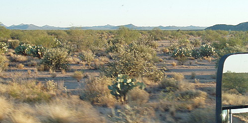 Now we see a lot of prickly pear cacti |
I was heading for Surprise, Arizona to find an RV campground for the night. Due to being behind on our schedule, the sun went down before we reached Surprise. As a result, I missed my turn-off in the dark; however, I did find the place to change our route to Arizona highway 303. This road was recommended by Tina to bypass non-freeway traffic through Phoenix. That worked fairly well until we arrived at I-10 where I turned east to go through Phoenix during the latter part of commute time traffic.
Due to road construction and heavy traffic the parade of vehicles slowed to a crawl at times, however, it was nice to not be dealing with traffic signals and 4-way stops. Kay looked in our directory for a campground somewhere ahead of us on I-10. A small RV park was found near the Picacho exit.
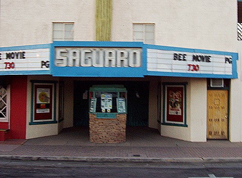 Theater seen in Wickenburg with an appropriate name for this area |
I called the campground and was told that the place had room for us. When I got off of the freeway I saw no directional signs for the RV campground. I stopped at the end of the off-ramp and called the campground again and was told "to just turn right and the RV park is a short distance up the road." We saw no lighted sign for a campground to guide us. I did see an area that appeared to be a lighted farm area around some out-buildings.
I ended up driving about 5 miles through a dark countryside and ended up back at I-10 where I pulled into the Eloy Flying J Travel Center to top off the fuel tank. I called the campground again and nobody answered the phone. Oh well.
With a full fuel tank I headed for Tangerine Road where another RV park was located near the junction of the two roads. Again there was no lighted sign in front of this RV park either. I just happened to catch a glimpse of what appeared to be an RV in the distance as our motorhome headlights poked holes in the darkness while making a turn. I found my way to the entrance to the campground where I found that it was full.
Now we were so close to our destination RV park that I continued on to Oracle Road where I turned north and began looking for The Wishing Well RV Park. Finally I found an RV park that had a lighted sign and turned in to park in front of the office. The time was about 10 o'clock and before I would find where the night registration was located, a woman asked if she could help. She explained that she managed the campground and that people normally didn't come in so late. Even so, the woman was very nice and helpful as she directed me to a site and said that I didn't need to register until the next day.
It was very nice to be off the road and set up for a couple of days. The weather was very comfortable when we arrived, however, I checked out the local weather forecast on TV as a way to end a very long day which ended with us reaching this campground a day early.
| NOTE: I had a lot of trouble finding my way around after dark due information signs not being lighted very well. We would learn later that there is a restriction to bright lighting in the area to decrease the effect of night-glow on the astronomical observatories in the area. This is called "Dark sky policy." |
| [ BEGIN ] | [ PREV ] | [ NEXT ] | [ RV FUN TRIPS ] |